The Indus River and Delta
Indus Delta and Shelf Survey
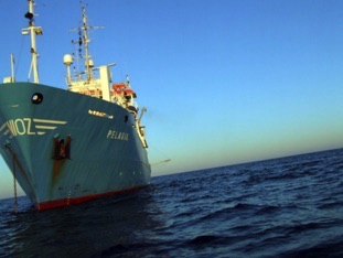
Cruise NERC 64PE300 of the RV Pelagia
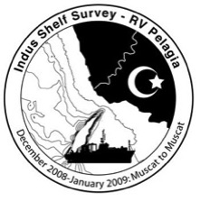
10th December 2008 to 7th January 2009
The Indus River meets the Arabian Sea just to the east of the city of Karachi, Pakistan, where it forms the 5th largest delta in the world, and feeds the world’s 2nd largest sediment body, the Indus Fan, which lies under the shelf and continental slope of Pakistan and western India, stretching ~1500 km south towards the Carlsberg Ridge. Although the outer shelf had previously been surveyed with shallow-penetrating seismic (Parasound) and bathymetry by the German Geological Survey (BGR) in 1993, the character of the inner shelf has not be imaged beyond basic plumb line soundings in the 19th and mid 20th centuries. In this cruise we set out to characterise the recent evolution of the delta and to understand its response to rising sea levels and intensifying summer monsoons since around 14,000 yrs ago.
Earlier coring studies on the fan by Prins & Postma (2000) had established that deep water turbidite sedimentation on the Indus Fan ceased around 11,000 yrs ago, in common with many other deltas that were flooded by rising sea levels. However, drilling of the coastal zone onshore has already established that the delta front in fact prograded out to sea at 14 to 8 ka, the time of most rapid sea level rise due to a greatly increased sediment flux caused by faster erosion in the Himalayan sources. However, the river has yet to re-establish connection with its submarine canyon and the deep sea fan. Our cruise was designed to understand what has happened to sediment reaching the river mouth since the Last Glacial Maximum (~20 ka) and especially during the Holocene.
Analysis of the existing bathymetry had already identified two important features of the delta. First that sedimentation is most rapid between the present mouth of the river and the head of the canyon. Secondly, that the shallowest parts of the shelf are much wider on the eastern side of the canyon compared to the western shelf (Giosan et al., 2006). Determining whether this area was an abandoned ancient lobe or whether it is still active was an important objective of the cruise.
Operations
Cruise 64PE300 started in Muscat, Oman on 11th December 2008 aboard the vessel RV Pelagia operated by Royal NIOZ. Our primary goal was to image and core the shallow sub-seafloor and documented thee nature of sediment transport in the Holocene delta. In deeper water and heavier sea conditions a shallow sub-seafloor image was generated using the shipboard, hull-mounted 3.5 kHz system. However, more detailed images were derived from towed instruments. We employed Woods Hole's Edgetech SB-512i “Chirp” seismic reflection system, which is optimised for imaging in the 200–200 m sub-seafloor range. Greater penetration was achieved using the Boomer and Sparker systems of the National Oceanography Centre, Southampton, UK.
Bathymetric mapping was performed using a multibeam Kongsberg EM302 Swath Mapper using a hull-mounted transducer. Data was recorded and processed shipboard using SIS Konsberg software. CTD casts were made using a Seabird 911 system with a transmissometer, optical backscatter, and fluorimeter mounted on a stainless steel frame with 24 10-liter bottles.
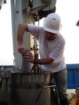
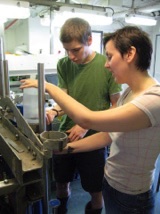
Coring was achieved using NIOZ’s own piston, gravity, box and multicoring systems. Samples from the multicorer were taken from tubes measuring 8 x 60 and 4 x 100 mm. Sub-samples from the box corer were also taken in 4 x 100 mm plastic tubes. Piston and gravity cores were 110 mm diameter and were split on the ship, described and stored at 4˚C in freezers in the hold prior to shipment to NOC, Southampton. Our operations were largely limited to the shelf regions oceanwards of the 12 nm territorial limit of Pakistan, although we did conduct a brief survey further offshore in deeper waters on the Murray Ridge to test our equipment and to survey for a possible IODP site.
Our coverage is shown in Figure 2. Most profiles recovered both Sparker and Chirp data, although rough sea states driven by strong northerly winter monsoon winds did sometimes require the Sparker and sometimes both systems to be be retrieved and the survey conducted only with 3.5 kHz and swath bathymetric mapping. As a general rule however the cruise recovered good quality data from most areas of the study region.
Coring recovered 157 m of material from different parts of the shelf but especially in the canyon itself and on the clinoforms exposed on either side of that feature. Swath mapping was able to make the first complete map of the Indus Canyon extending the previous work up to the 12 nm territorial limit and out into the deep sea ca. 1600 m water depth, but not so far that the canyon ceased to be erosive. One of the most important achievements of the cruise was the recognition that the clinoform on the eastern side of the canyon has prograded much further towards the shelf edge compared to the clinoform on the western side. Both appears to be incised and blanketed by Holocene sediment and appear to relict features. Most modern sediment discharged from the Indus is being fed straight to the head of the Indus Canyon.
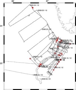
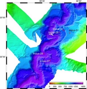
Figure 2. Trackline chart of the geophysical surveys conducted during cruise 64PE300. Red stars show the coring locations.
Figure 1. Swath bathymetry map of the lower canyon showing meanders and oxbows, as well as the locations of core sites in the channel and surrounding terraces.
Major achievements
This cruise represents the first scientific oceanographic expedition on the inner shelf for more than 50 years where the results will published in full for the open community. Key achievements of the cruise include:
1) A detailed bathymetric map of the Indus Canyon stretching from the 12 nm territorial limit to the deep sea.
2) Confirmation that the clinoform on the western side of the canyon lies much closer to the coast than on the eastern side.
3) Seismic proof that both clinoforms are relatively old features that have been incised and mantled with Holocene delta muds.
4) Most recent sedimentation has been in the head of the canyon. This sediment has yet to be reworked on to the fan, but is piling up and slumping in large rotated slump blocks. Delta and canyon appear to be regions of significant sediment buffering between source and sink.
5) The canyon is clearly an old structure that has been incised in a series of phases.
6) Although the outer shelf edge is characterized by slumping and the headward growth of canyons there has been little direct supply of sediment to the outer shelf since the Last Glacial Maximum.
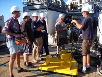
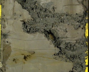
Figure 4. Science party get ready to launch the Chirp seismic system
Figure 3. Core of sediment below unconformity on shelf NW of the Indus Canyon. The sediment is stained orange from weathering during exposure at the Last Glacial Maximum, ca. 20 ka and is burrowed by bivalves whose shells are found in the burrows infilled by green-grey Holocene silty mud
Participants
Peter Clift - Regional Geology and Monsoons
Department of Geology and Geophysics, Louisiana State University, Baton Rouge, LA 70803, USA (at University of Aberdeen, UK at time of cruise)
Tim Henstock - Seismology and Geophysics
National Oceanography Centre, University of Southampton, European Way, Southampton, SO14 3ZH, UK
Liviu Giosan - Coastal Sedimentology and Holocene Climate
Department of Geology and Geophysics, Woods Hole Oceanographic Institution, Woods Hole, MA 02543, USA
Ali R. Tabrez - Sedimentology and Marine Geology
National Institute for Oceanography, ST-47-Block 1, Clifton, Karachi 75600, Pakistan
Tim Dellapena - Sediment Transport Processes
Department of Marine Sciences/Oceanography Dept., Texas A&M University at Galveston, Galveston, Texas 77554, USA
National Oceanography Centre, University of Southampton, European Way, Southampton, SO14 3ZH, UK
Cornelia Köhler- Climate Change and Monsoons
FB5 Geowissenschaften, Universität Bremen, Klagenfurter Strasse, 28359 Bremen, Germany
Naeem Ahmed - Physical Oceanography
National Institute for Oceanography, ST-47-Block 1, Clifton, Karachi 75600, Pakistan
David Limmer - Sedimentology
Department of Geology and Petroleum Geology, Meston Building, University of Aberdeen, Aberdeen, AB24 3UE, UK
Camilo Ponton - Climate Change
Department of Geology and Geophysics, Woods Hole Oceanographic Institution, Woods Hole, MA 02543, USA
Orji Akaa - Sedimentology and Heavy Minerals
Department of Geology and Petroleum Geology, Meston Building, University of Aberdeen, Aberdeen, AB24 3UE, UK
Lt. Haris Sarwar Rana - Physical Oceanography, Naval Observer
Hydrographic Department, Pakistan Navy, 11, Liaquat Barracks, Karachi, Pakistan
Acknowledgements
We wish to thank NERC and NSF for the financial support that made this cruise possible. We further thank the Government of Pakistan, especially the Ministry of Science and Technology and the Hydrographic Department of the Navy for permission to conduct surveys within the EEZ of Pakistan. Jez Evans at National Oceanography Centre, Southmapton did a great job in making sure our equipment arrived in Muscat when we needed it and got our materials home to us. The science party expresses its gratitude to the professionalism of the crew of the RV Pelagia and to all the support staff as NIOZ for their hard work in making our cruise a success.
This cruise represents a contribution to the work outlined in the Memorandum of Understanding between National Institute of Oceanography (Karachi) and the University of Aberdeen.