
 |
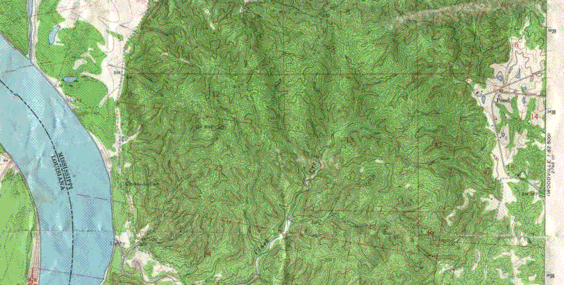
| The Clark Creek area is full
of hills, as well as valleys and level bits of land that range in elevation
from 400 feet above sea level to 100 feet above sea level. The highest
point in the area is on the East side near the small road that leads to
the parking lot where the trail begins. Pond, MS, is in the upper right
hand corner of the map in the deforested area (white area containing a
small pond). The lowest point is located on the floor of the creek , a
mere 100 feet above sea level. The trek starts off following a narrow drainage
divide and drops nearly 200 feet in less than half a mile, not to mention
the twists and turns throughout. Local relief on the this and other divides
may be as great as 100 feet. The changes in the land surface are the result
of erosion by the temporary streams draining into Clark Creek. The dissected
area is part of the local togographic feature known as the Tunica Hills.
In the area there are 4 beautiful waterfalls, ranging from 16 to 25 feet
in height (and several smaller ones). Cemented zones in the Fleming
Formation form the erosion resistant zones that are responsible for
the waterfalls.
Be careful walking in the area, some of the trails are steep and the footing can be treacherous. |
![]()
![]()