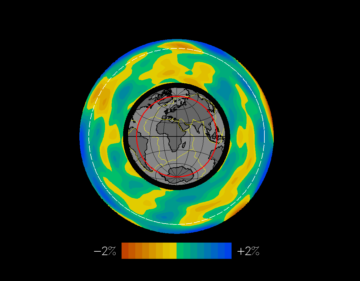
Tomographic image of a cross section through the Earth. The section corresponds to the red line on the inset map. The dashed white line indicates the 670 km seismic discontinuity (upper/lower mantle boundary), the thick black line indicates the boundary between the mantle and outer core. Blue (or positive velocity perturbation) indicates "fast" areas and red (or negative velocity perturbation) indicates "slow" areas, relative to sound wave propagation. Notice the correlation of blue areas in the mantle underlying the continents, and red areas in the mantle underlying spreading ridges. Taken from Su, Woodward, and Dziewonski,1994. To see a different slice through the Earth click here.