
THE COLEVILLE DELTA
Delta ID # 05
Latitude 71N Longitude 151W.
Drainage basin:
Depositional basin: Beaufort Sea.
Climate:
Air temperature range: oC to oC
Tidal amplitude:
Mean wave height:
Discharge:
Drainage Basin area:
Image ID:
Acquired:
Delta type
Geo-referenced files
Description
Contributed by Professor James Coleman, LSU.

The Colville River, the largest river in northern Alaska, enters the Arctic Ocean about 240 km east of Barrow, Alaska. The river drains a basin that is 49,500 sq km in area (Figure 35). The entire basin lies in the zone of continuous permafrost and is snow covered for 8-9 months of the year. Snow melt and river flow begin in May with river breakup within the delta occurring in late May or early June. During breakup, as much as two-thirds of the delta is covered by flood waters [05-i04].
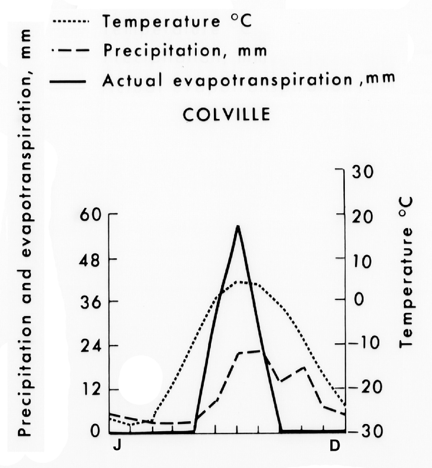
The monthly temperature, precipitation and evapo-transpiration is shown in 05-g02.
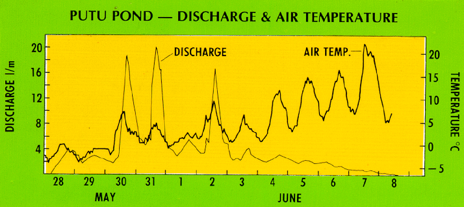
The basin displays moderate relief (470 m average relief) and has an average elevation of 410 m, with a maximum of 1,350 m and a minimum of 20 m. The main channel of the Colville River is some 567 km in length from its headwaters to the river mouth at the Arctic Ocean. The river channel is sinuous throughout its length and meandering is common in most of the alluvial valley. Discharge is quite peaked and the average annual discharge is 491 cu m/sec, with a range of 1,075 cu m/sec. Generally three major discharge peaks occur at the end of May and early June [05-g01].
05:i04 is a satellite image of the alluvial valley of the Colville River and as can be seen, the river leaves the foothills of the drainage basin and enters the North Slope Coastal Plain where a large number of oriented lakes and permafrost polygons exist [05-i03].
The delta that has resulted from these deposits is roughly triangular in nature and covers an area of 1,687 sq km. It is composed primarily of sand and finer-grained silts and clays. Thick peat deposits are also common in the delta plain. The subaerial delta is much smaller than the subaqueous delta; the ratio of the subaerial/subaqueous delta is 0.51. The eastern part of the delta is the most active part of the delta and the ratio of the abandoned/active delta is quite high. The Colville delta is rather smooth and the shoreline length to delta width is 1.73 [05-i05].
The most conspicuous geomorphic forms present in the delta are: 1) active distributaries, 2) lakes, great in number and varied in size and shape, 3) sand dunes, and 4) polygons (Walker, 1961). Most of the lakes are small and drain to the distributaries through seepage over the permafrost. The sand dunes vary greatly in size and age. The youngest dunes are found almost exclusively along the western banks of the present distributaries, whereas the older dunes are associated with older abandoned distributaries along the western margin of the delta plain. Within the delta plain there are nearly 60 bifurcations and 29 rejoinings. At normal river stage, there are approximately 34 active river mouths. The beds of the distributary channels are highly braided at low river stages, and often gravel lags occur.
The tides in the Arctic Ocean are low, averaging only 0.21 m. The offshore slope is extremely low (0.038 degrees) and thus wave action is extremely low. The root mean square wave height is 0.07 m. In addition, the bottom-fast ice that occurs the vast majority of the year precludes any significant wave action.