
THE PO DELTA
Delta ID # 32.
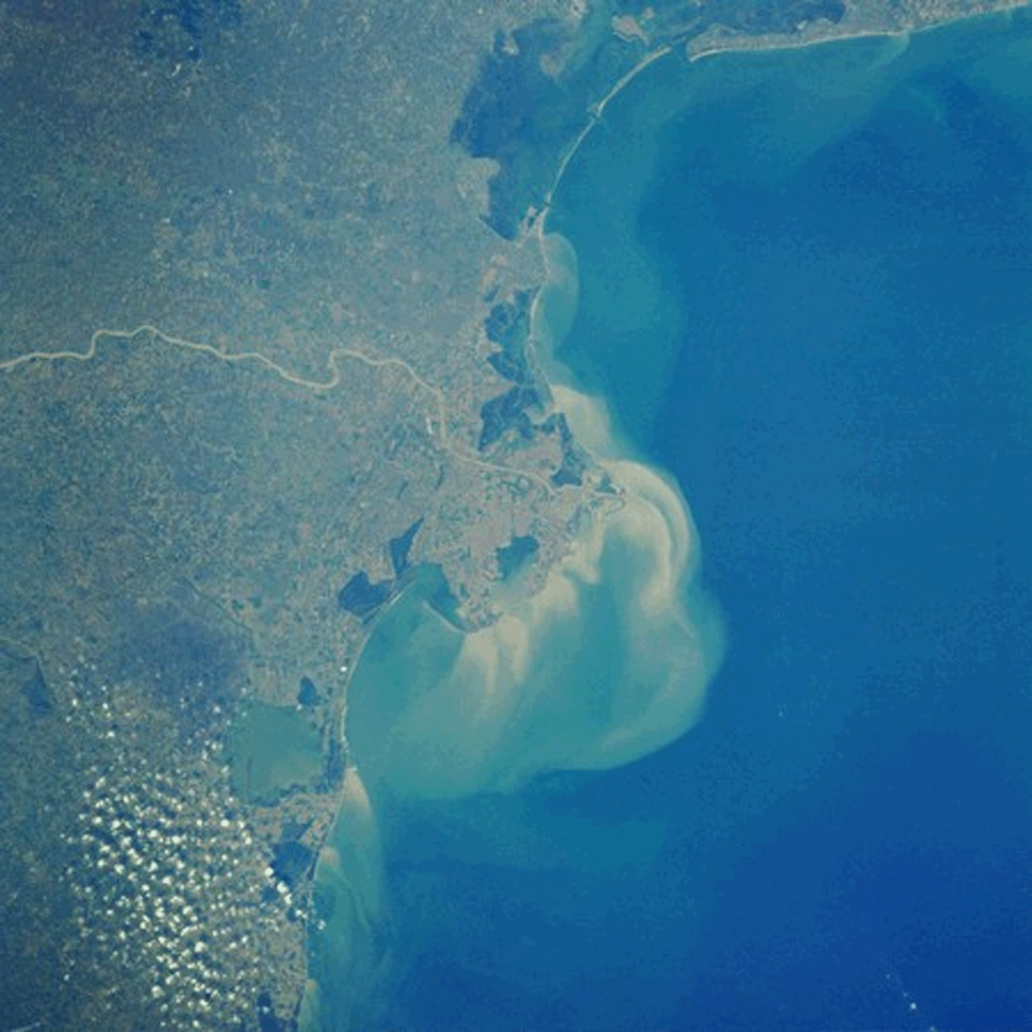
Po River Delta, Italy, Europe
LOCATION LAT. 44°36’N, LONG. 11°29’E
LANDMASS DRAINED ITALY, EUROPE.
BASIN OF DEPOSITION ADRIATIC SEA
CLIMATE HUMID SUBTROPICAL (Caf)
AIR TEMP RANGE -0.4°C TO 22.8°C
TIDAL AMPLITUDE 0.7 M
TYPE SEMIDIURNAL
DISCHARGE SEDIMENT 15X10
6TONS/YRDRAINAGE BASIN AREA 7.17X10
4 KM2ID 7192029000104651, PATH 192 ROW 29
IMAGE ACQUIRED FEBRUARY 15, 2001
Geo-referenced files
Description
Contributed by Professor James Coleman, LSU. From: Coleman and Huh, 2004.

The Po River System rises in Alps and flows for some 382 km to empty into the Adriatic Sea. The drainage basin drains the steep mountains of the Alps and most of the drainage basin is occupied by Paleozoic and Mesozoic sedimentary rocks. The average elevation of the drainage basin is quite high, being 1,115 m, with a maximum of 2,450 m and a minimum of 60 m. Average relief in the basin is high, being 480 m. Average annual rainfall in the basin is 1,179 mm, with a maximum of 1,921 mm and a minimum of 599 mm. The rainy months lasts from April through October and the dry months are from November through March. The drainage density of the tributaries is moderate, the average density being 0.21 stream kilometers per 500 sq km (Figure 76).
The alluvial valley is well-defined (32-i01]) and displays a restricted meandering pattern throughout most of its length. The average annual discharge is 3,411 cu m/sec, with a maximum of 13,760 cu m/sec (February) and a minimum of 969 cu m/sec (August). Discharge is fairly uniform all year long. The protruding delta has an area of 13,398 sq km. Tidal range is extremely low (0.73 m), and little or no tidal channels are observed on aerial photo images. Wave action is moderate, with a root mean square wave height of 1.53 m. The delta shoreline is characterized by well-developed flanking barrier islands (Plate 31) with broad lagoons situated behind the barriers. Most of the delta plain has been extensively modified by man for agricultural purposes and are indicated by the pink and red colors in the satellite image (32-i02). This delta has been extensively prograding since the onset of the Little Ice Age (ca. 1450-1850 AD) and the average progradation rates are 129 m/yr. The Po River basin is especially subjected to vertical movements in its southern margin and in the delta area.
From cartographic comparisons (MURST, 1997), in the first 60 years of the century the coastal plain subsided from -3 mm/yr. (southern margin) to -8 mm/yr. (delta top). The maximum depression occurs in the core of the Po delta reaching -5 m below mean sea level. In the city of Venice, after the pumping of fresh groundwater was halted in 1970, subsidence switched back to an average rate of 0.4 mm/yr.