
THE EBRO DELTA
Delta ID # 08.
Contributed by Huh et al, 2004.
Ebro River Delta, Spain, Europe
LOCATION LAT. 40°20’N, LONG. 00°44’E
LANDMASS DRAINED SPAIN, EUROPE.
BASIN OF DEPOSITION MEDITERRANEAN SEA
CLIMATE MEDITERRANEAN (Csa)
AIR TEMP RANGE 10°C TO 30°C
TIDAL AMPLITUDE 0.2 M
TYPE SEMIDIURNAL
DISCHARGE WATER 552M3/S, SEDIMENT 6.2X10
6 TONS/YRDRAINAGE BASIN AREA 8.58X10
4 KM2ID 7198032000213950, PATH 198 ROW 32
IMAGE ACQUIRED MAY 19, 2002
Geo-referenced files
Description
Contributed by Professor James Coleman, LSU. From: Coleman and Huh, 2004.

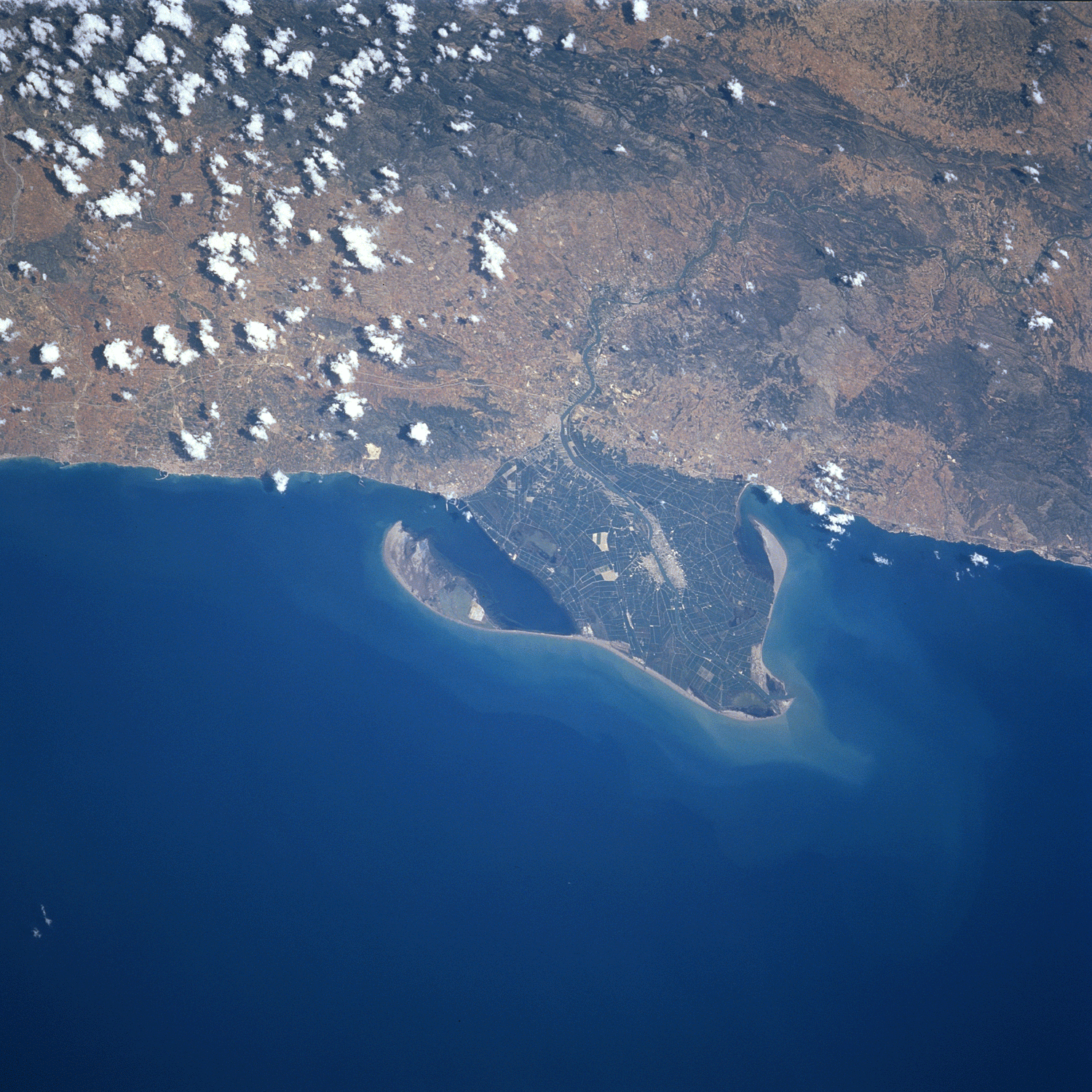
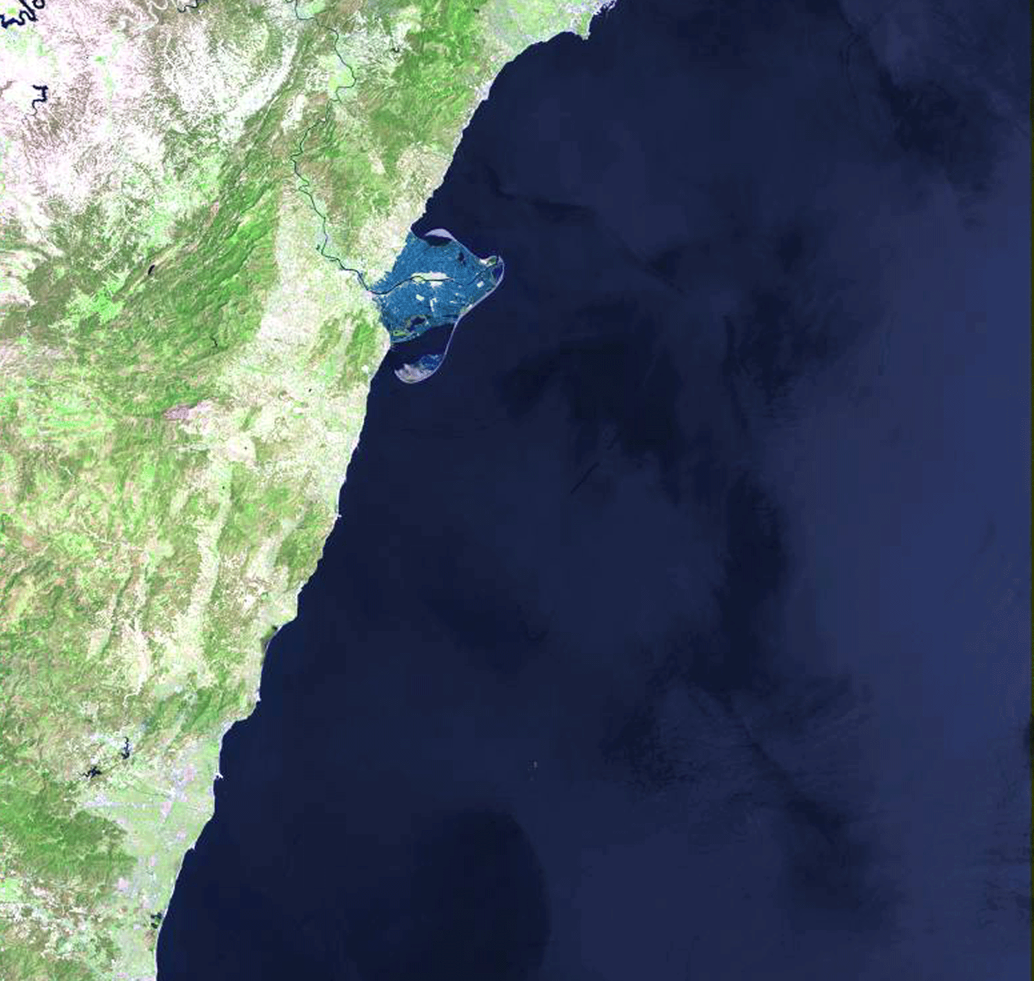
The Ebro River system rises in the steep foothills of central Spain and flows for some 624 km before entering the Mediterranean Sea in a highly protruding delta plain. The western portion of the basin originates in the Western Spanish Trough and the Tajo - Dueres Basin composed Cretaceous and Carboniferous sedimentary rocks. The central and eastern basin lie in the Iberic Cordillera composed of Paleogene and Neogene sedimentary rocks. Drainage density is relatively low (Figure 40) and the main channel meanders through relatively narrow gorges for most of its length. Much of its course is determined by geologic structure. The drainage basin is some 85,100 sq km in size. The average relief in the basin 402 m and the average elevation is 854 m. Maximum relief 1,893 m and minimum relief is 260 m. Because of the relatively high altitude and mountainous nature of the drainage basin, temperatures are below freezing for a few months of the year. The average annual rainfall is 745 mm with a maximum of 1,337 mm and a minimum of 453 mm. Rainfall is spread evenly throughout the year, with a maximum of 75 mm in December and a minimum of 35 mm in July. The northern rim of the drainage basin is dominated by temperate broadleaf and mixed forests and the remainder of the basin consists of Mediterranean scrub vegetation.
The alluvial valley is not particularly defined and the main channel cuts through several narrow structurally controlled gorges. The average annual discharge is relatively low, being only 420 cu m/sec. Flow is relatively uniform all year long. The delta protrudes significantly into the Mediterranean Sea and has an area of 624 sq km. The offshore slope is quite steep, averaging some 0.31 degrees and is one of the higher offshore slopes seen in deltas. Thus wave energy is quite high, the wave power being 0.155 x 10⁷ ergs/sec/m/coast and the root mean square wave height is 1.53 m. Tides are virtually absent in the Mediterranean Sea and no evidence of tidal channels is present in the delta [08-i01]. Salt water intrusion, however, is quite evident from the numerous saline and evaporite flats that are present within the delta. Man has modified much of the original delta plain and much of the delta is used for agricultural purposes. Small dikes and levees surround these agricultural regions. Protruding from the river mouths are very large barrier island spits [08-i02]. The presence of these recurved spits indicate that strong littoral currents are present along the shoreline. No evidence is apparent on the satellite image of former river channels and presently, man has controlled the river and no migration of the channel occurs.