THE DNIEPR DELTA
Delta ID # 07.
Dniepr River Delta, Ukraine, Europe.
LOCATION LAT. 46°01’N, LONG. 32°03’E
LANDMASS DRAINED EUROPE
BASIN OF DEPOSITION BLACK SEA
CLIMATE MIDDLE LATITUDE STEPPE (BSk)
AIR TEMP RANGE -27.4°C – 26°C,
TIDAL AMPLITUDE 0.09 M
DISCHARGE WATER, 17 000 M
3/S,ID 7179028000213450, PATH 179 ROW 28
IMAGE ACQUIRED MAY 14, 2002
Delta type:
Geo-referenced files
Description
Contributed by Professor James Coleman, LSU. From: Coleman and Huh, 2004.

The Dneipr River is one of the longest rivers in Europe, some 2,300 km long. It rives in the Valdai Hills, west of Moscow, Russia and flows into the Black sea. The drainage basin, some 495,500 sq km in size, is located in the rugged mountains of central Russia. The northern part of the basin is dominated by Devonian and Cretaceous sediments, the western basin lies with Cretaceous and Paleogene sediments, while the southern part of the basin lies within Paleogene sediments with scattered Precambrian granites. The river’s headwaters are located in the Pripzat and Dneipr basins, while the northern boundary of the basin lies in the Belorussian - Voronezh High and the southern basin is defined by the Ukrainian Shield. The average relief in the basin is relatively low, being only 45 m and the average elevation of the basin is 150. Maximum elevation is 2,600 m, while the minimum elevation is 60 m. Tributary density in the basin is quite high (Figure 39). About half of the year, the temperature of the drainage basin is below freezing, thus reducing the river flow for a considerable amount of the year. The average annual rainfall is 489 mm, while the maximum and minimum are 631 and 461 mm, respectively. Rainfall is highest in the months of July through September and thus discharge highest in these months. Average annual discharge is 1,482 cu m/sec with a maximum of 2,893 cu m/sec (month of March) and a minimum of 842 cu m/sec in the month of July. Discharge is quite erratic year from year and yearly variation is quite high. Since the construction (1932) of the Dniprohes dam, the Dniepr is navigable for virtually its entire course and discharge is more controlled.
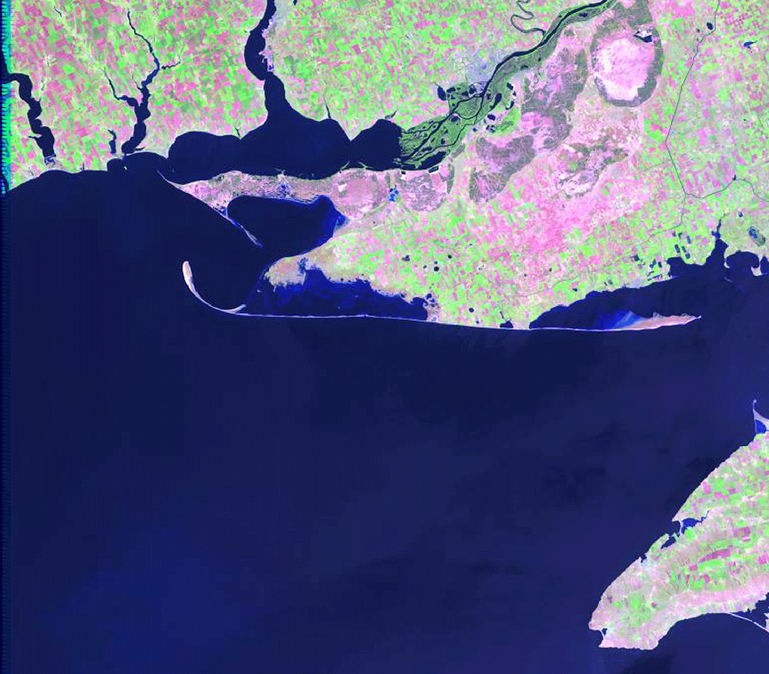
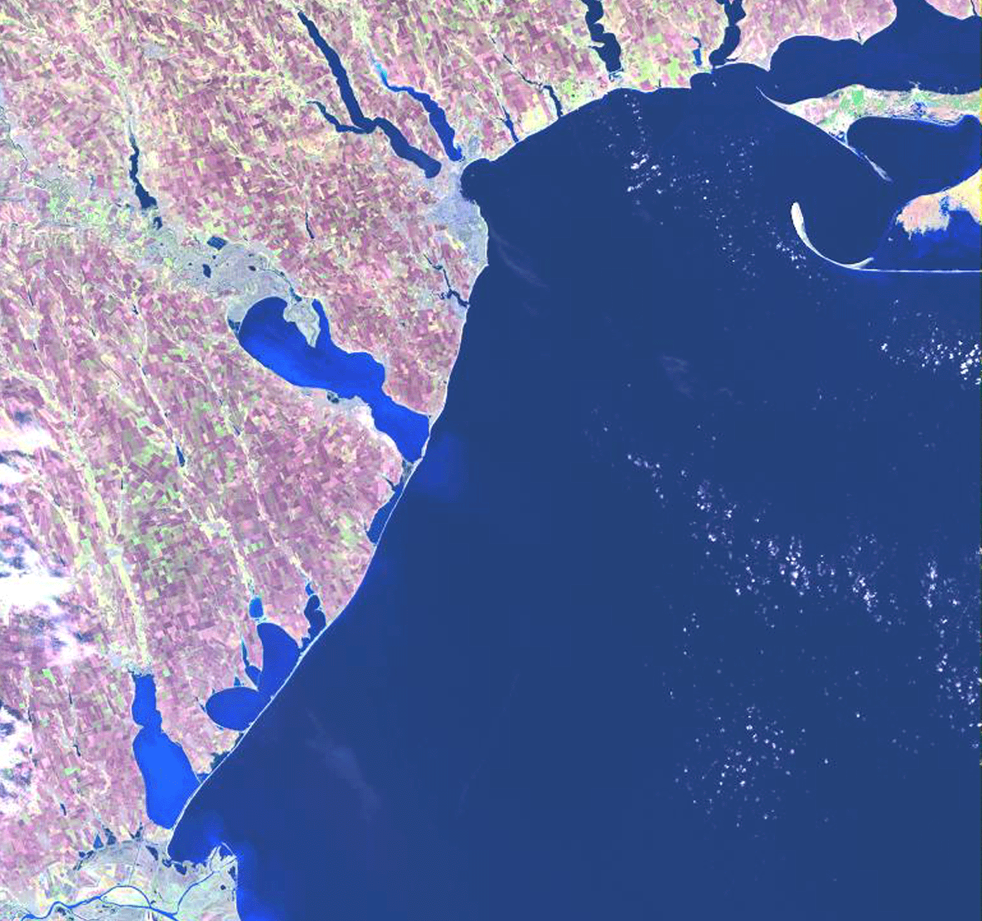
The alluvial valley is well defined and the river displays meandering tendencies along most of its length, with evidence of numerous meander belts. The river flows down a topographic low rift-like basin for most of its length. This is especially apparent in the lower river course where the delta enters the Black Sea well inland from the main coastline . Being sheltered from wave energy in the Black Sea, few beaches are present in the delta proper and root mean square wave height is 0.23 m. Beyond the delta, along the main northern coast of the Black Sea, long, narrow barrier spits [07-i01] and islands are present [07-i02]. The distributary pattern displays some bifurcations and several rejoinings. Several lakes and interdistributary bays are present in the delta. Marsh vegetation is extensive in the delta plain. This delta is a classic example of a river system confined by structural features and does not allow normal delta switching processes to occur.