THE CHAO-PHARYA DELTA
Delta ID 04
Contributed by Huh et al, 2004.
Chao Phraya River delta, Thailand, Asia
LOCATION LAT. 13°00’N, LONG. 100°24’E
LANDMASS DRAINED THAILAND, ASIA
BASIN OF DEPOSITION GULF OF THAILAND, PACIFIC OCEAN
CLIMATE TROPICAL SAVANNA (Aw)
AIR TEMP RANGE 24°C – 40.4C,
TYPE OF TIDE SEMIDIURNAL
ID 7129051000200850 PATH 129, ROW 51
IMAGE ACQUIRED JANUARY 8, 2002
Delta type:
Geo-referenced files
Description
Contributed by Professor James Coleman, LSU. From: Coleman and Huh, 2004.

The Chao Phraya River is located in the country of Thailand and empties into the Bay of Bangkok. The Chao Phraya basin is the most important river basin in Thailand www.unesco.org/water/wwap/case_studies/chao_phraya/index.shtml. The Basin covers 30% of Thailand's land area, is home to 40% of the country's population, employs 78% of its work force, and generates 66% of its Gross Domestic Product (GDP). The total population of the Chao Phraya basin was 23.0 million inhabitants in 1996. The headwaters of the Chao Phraya river originate in mountainous terrain in the northern part of the country and consist of four large tributaries, the Ping, Wang, Yom and Nan rivers. The drainage basin comprises some 992,000 sq km in area and has a relatively low relief (average 176 m). The elevation of the basin, however, is quite high, averaging 1,033 m in elevation. Drainage density (0.19 km stream length per 500 sq km) is quite low for such a large basin. Over 90% of the area of the basin is either used for agriculture or covered with forest, with the proportions of these land uses being roughly equal.
The flows in the Chao Phraya and its tributaries are dependent on the monsoon rains during May to October and are highly seasonal. Average annual precipitation in the Chao Phraya basin varies from a minimum of 1,000 mm in the western part to about 1,400 mm in the headwaters and up to 2,000 mm in the eastern Chao Phraya delta. Variations from year to year, which are responsible for floods and droughts, are key factors in determining the availability of the basin's water resources. About 85% of the total runoff occurs in the months of July to December, and natural flows are small in the January to June period. Average annual runoff recorded in the upper Chao Phraya basin varies from about 250 mm in the sub-basin of the Ping above Bhumibol reservoir to some 450 mm in the sub-basin of the Nan above Sirikit reservoir. Average annual runoff for the Chao Phraya river at Nakhon Sawan is 226 mm. Annual average river discharge is 883 cu m/sec and the discharge range is 2,838 cu m/sec. The hydrological cycle starts in April when the discharge is typically at its minimum. From May to August the discharge gradually increases, while from August to October the increase is more rapid, peaking in October. The discharge then decreases fairly rapidly during November and December, with the rate of decrease then slowing until minimum flow conditions are again experienced in April. During the low flow periods from January to April the discharge typically ranges from 50 to 200 m3 sec-1. Tidal intrusion extends to Angthong (175 km) during low stream flow conditions and to about 75 km upstream during high stream flow conditions. The river, from its headwaters to the delta mouth is 866 km long. The depth of the river ranges from 5 to 20 m and the width ranges from 200 to 1,200 m. The river traverses several large cities and the major agricultural region of the country, hence this river receives large amounts of wastes along its path.
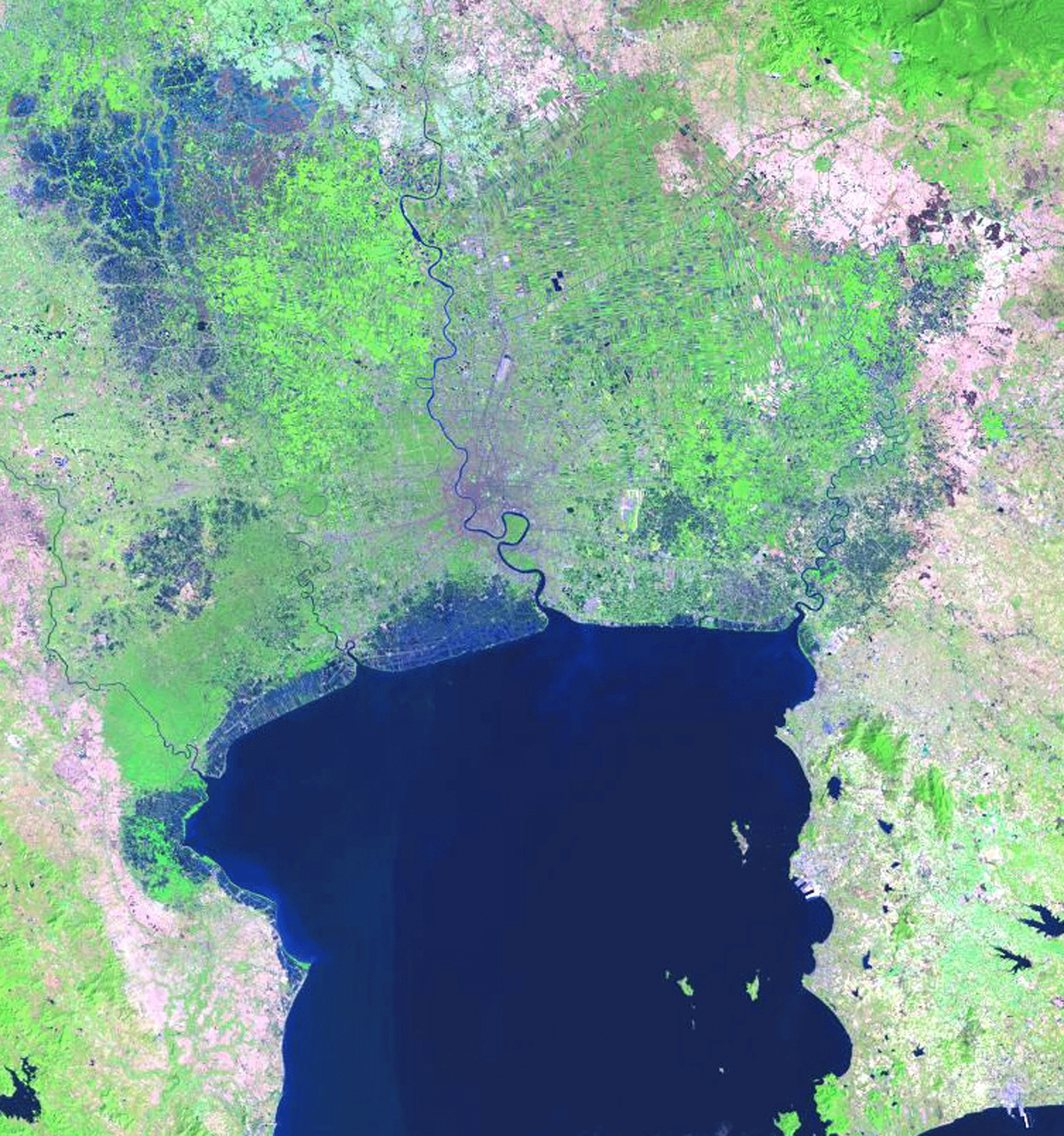
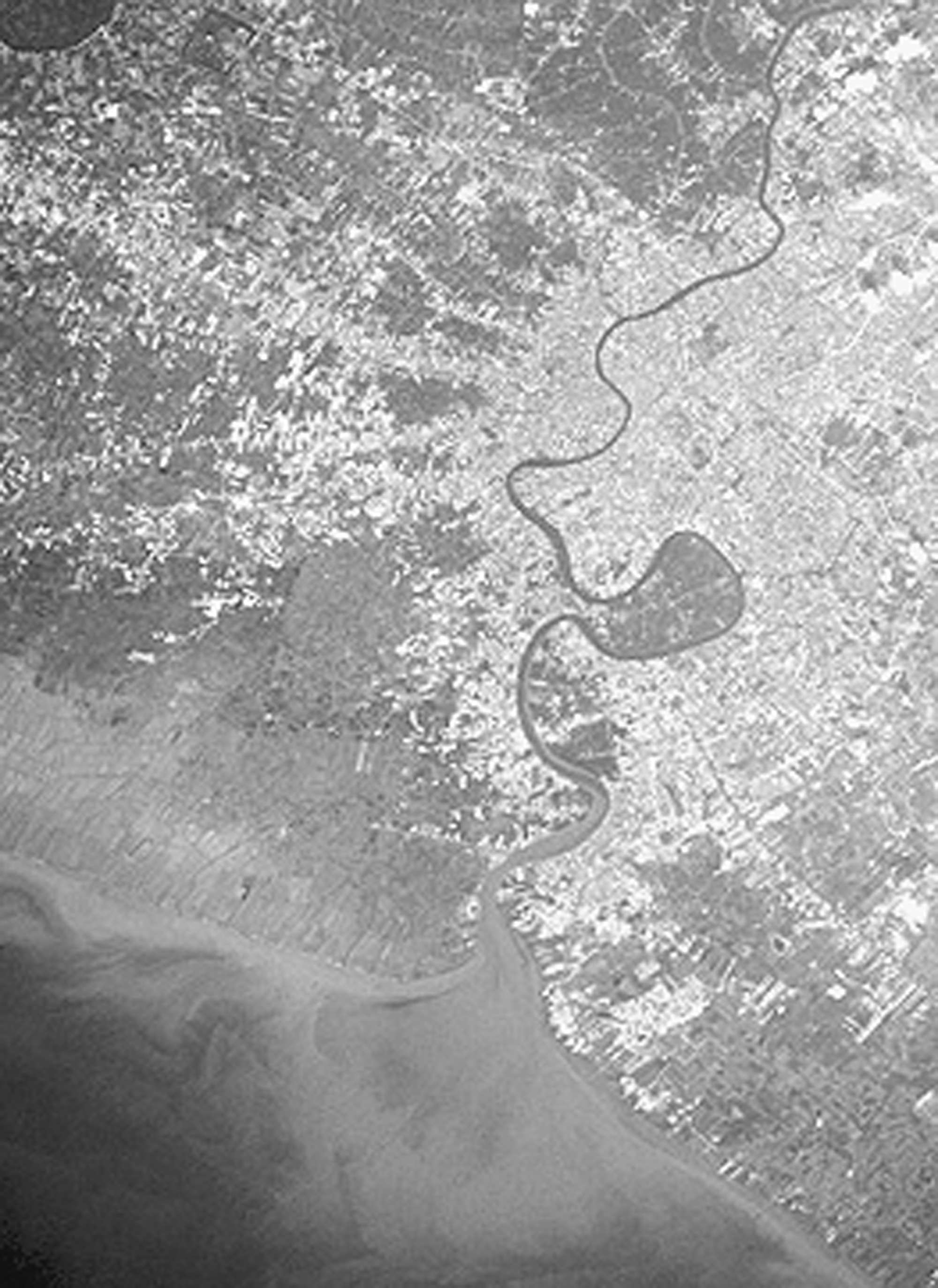
04-i01 illustrates the river has but a single distributary and the river mouth is quite embayed. Tidal range is quite high, some 2.38 m in range. Offshore slope is extremely low, averaging only 0.0041 degrees along the delta front. As a result, wave energy is quite low. Calculated wave power along the shoreline is 0.736 x 10⁷ ergs/sec/m coastline and the root mean square wave height is 0.23 m. The delta is some 11,329 sq km in area and the subaerial delta is some seven times larger than the subaqueous delta and ratio of subaerial/subaqueous delta area is 7.38. The ratio of the abandoned to active delta is 8.95; only a small part of the delta is active today. The front of the delta is rather smooth with the ratio of the shoreline length to the width being 1.15. This smoothness is not the result of extensive wave action, but occurs of the extremely large fine-grained sediment load that is delivered to the coast each year. 04-i02 shows the extremely muddy plume of the river during flood stage.
The influence of humankind.
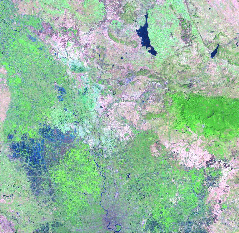
The delta plain has been radically modified for industrial use and is heavily cultivated, primarily in rice and as can be seen in 04-i03 and 04-i01. The only natural feature is the thin strip of mangrove covered muddy tidal flats that front the delta.