THE PUNGUE DELTA
Delta ID # 33.
Contributed by Huh et al, 2004.
Pungue River delta, Mozambique, Africa
LOCATION LAT. 20°13’S, LONG. 34°27’E
LANDMASS DRAINED AFRICA
BASIN OF DEPOSITION INDIAN OCEAN
CLIMATE TROPICAL SAVANNA (Aw)
AIR TEMP RANGE 25°C – 40.5°C,
TYPE OF TIDE SEMIDIURNAL
ID 7167074000112750, PATH 167 ROW 74
IMAGE ACQUIRED MAY 7, 2001
Delta type:
Geo-referenced files
Description
Contributed by Professor James Coleman, LSU. From: Coleman and Huh, 2004.

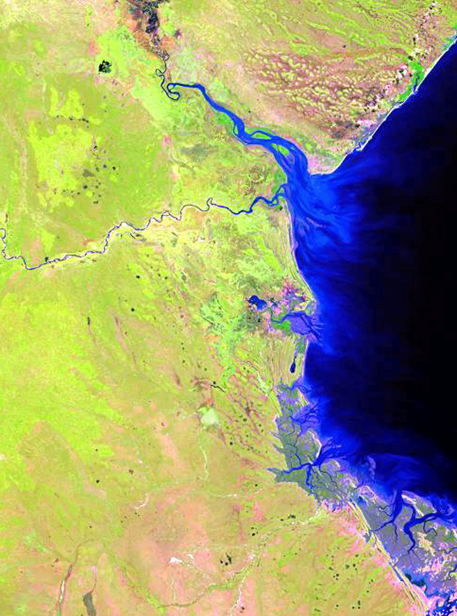
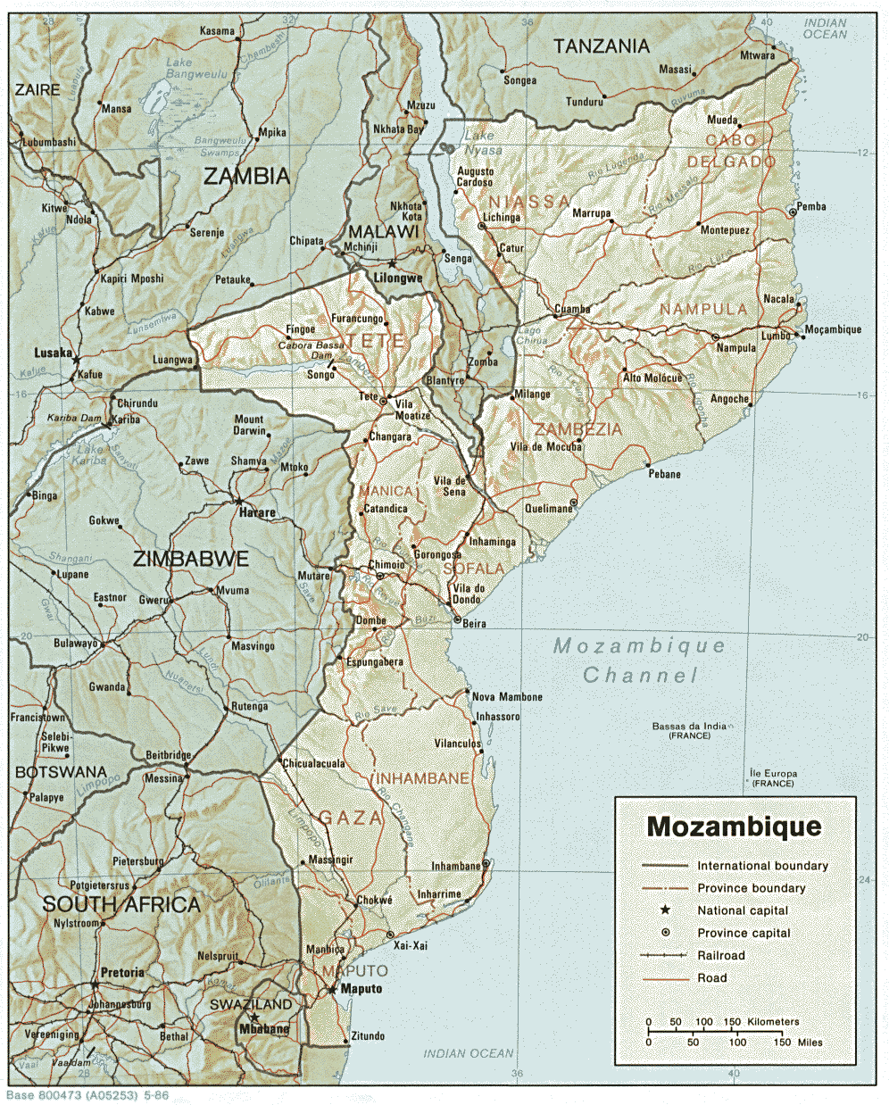
The Pungue (or Pungoe) River system is located in the country of Mozambique [33-i04] and has a drainage basin area of 32,711 sq km. The main channel of the river is some 390 km in length. Ninety percent of the drainage basin drains the East Kalahari Precambrian shield area. The high resistance of the rocks to erosional processes results in a very low drainage (Figure 77, Coleman and Huh, 2004.). The average elevation of the basin is 436 m, quite low for such a large drainage basin. Maximum elevations attain only 997 m and the minimum elevation is 83 m. Rainfall is quite high, the average annual rainfall being 1,130 mm, with a maximum of 1,363 mm and a minimum of 919 mm. The rainy season lasts from November through April when monthly average rainfall rarely falls below 100 mm. The dry months are May through October and the average monthly rainfall seldom exceeds 20 mm. Thus there are distinct wet and dry seasons within the basin. Thus most of the vegetation in the basin consists of tropical and subtropical grasslands and savannas.
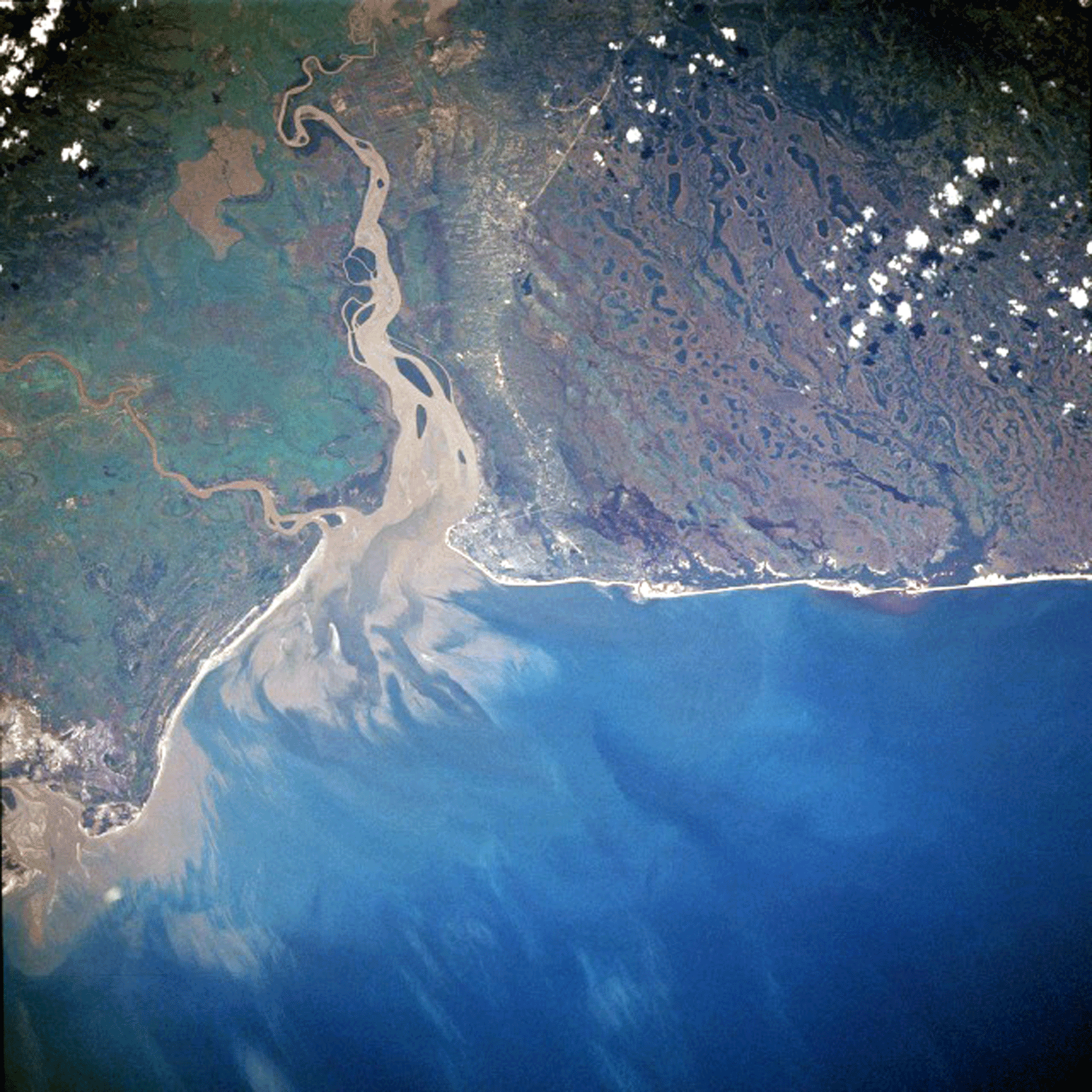
The alluvial valley is well defined and has a length of 180 km. The river displays a meandering pattern throughout its length, with the more defined meander belts located in the southern part of the valley. The average annual river discharge is 137 cu m/sec, with a maximum of 513 cu m/sec in March and a minimum of 28 cu m/sec in September. The delta is primarily a tidal estuary, and tides are extremely high, as evidenced by the extensive tidal network seen along the coast [33-i02]. A prominent tidal bore exists and some 50 km inland, the bore displays a height of 0.7 m. The delta area is only 413 sq km in size and the river mouth displays a broad bell-shaped pattern characteristic of high tidal deltas [33-i03]. Wave energy is moderate along this part of the coast and several prominent beach ridges are present along the shoreline.